Bangalore Tree Survey – POC Results
Bangalore, once upon a time called Garden city, still has quite a bit of green cover. Almost every week we read a story about cutting down trees for some reason. But nobody knows the details, including the people who write those articles. I thought it would be great if you had a baseline survey of trees, which can be used for comparing, or many other stories and studies. But imagine mapping every public tree (tress in public areas like road, parks etc) in Bangalore. It will probably take years if I start doing it alone. But then there wa no way to find out other than trying it out.
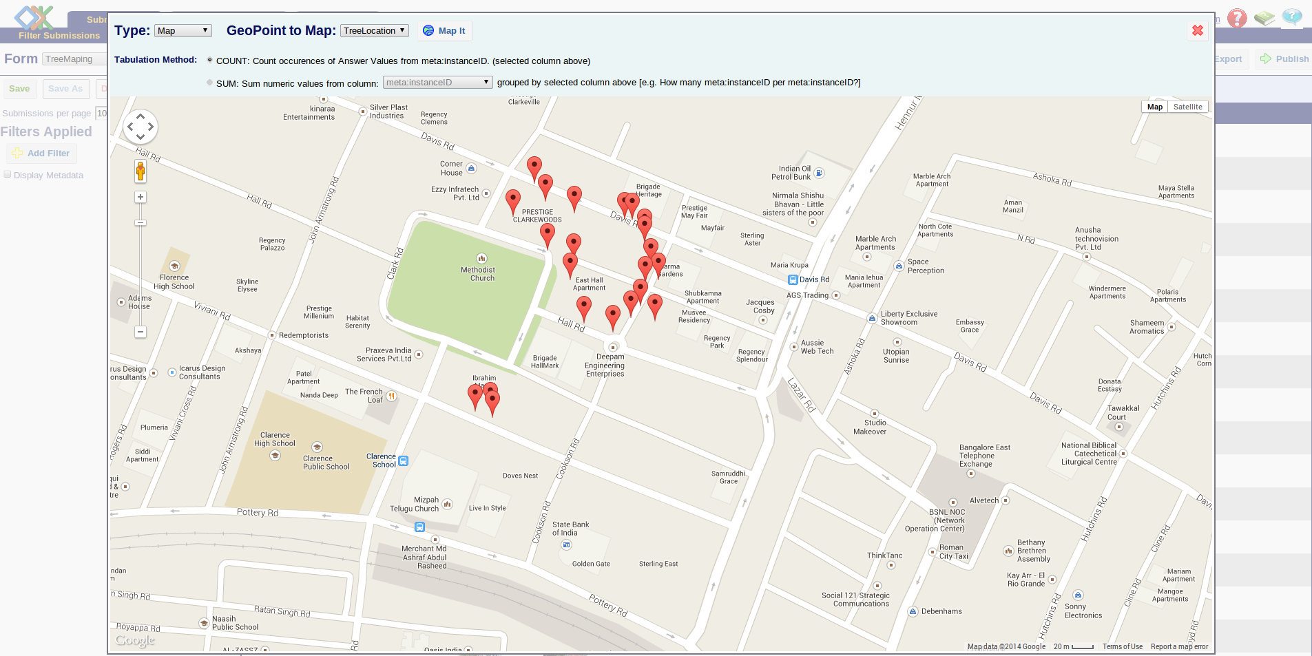
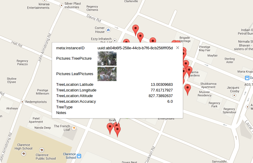
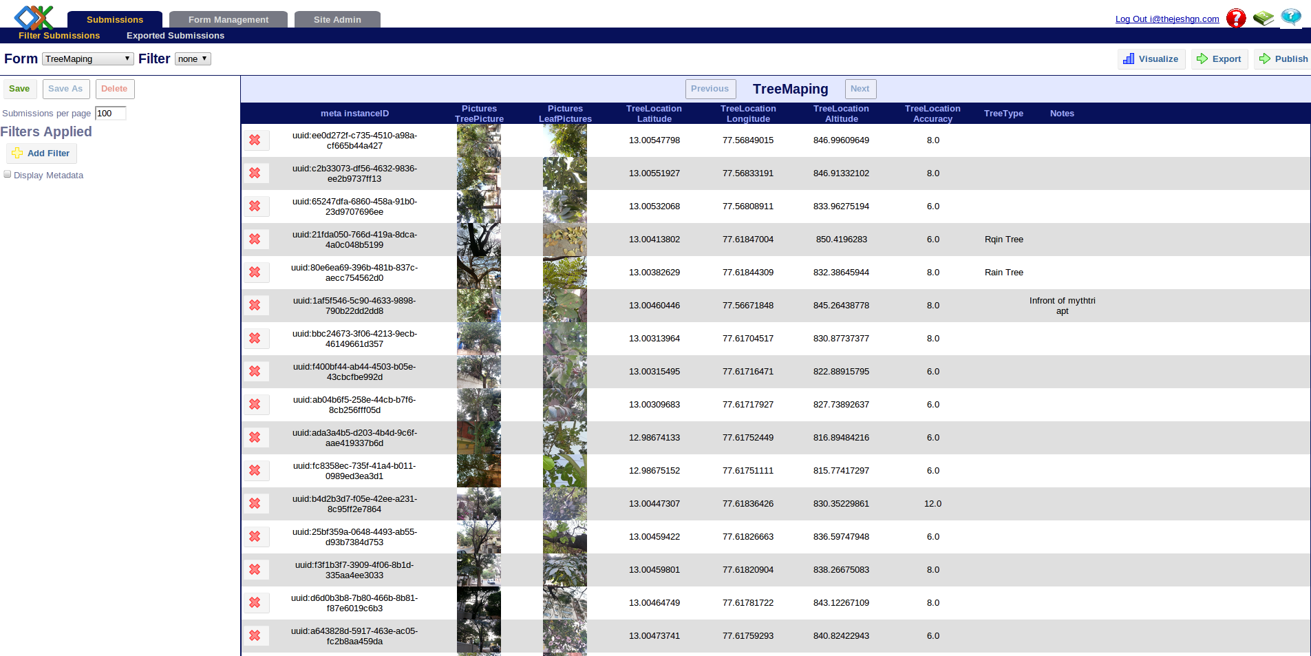
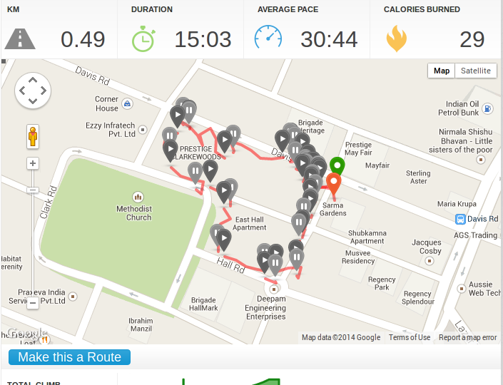
So I asked DataMeet as usual. I figured that a PoC by me would be a great place to begin. Hence I installed ODK on my phone and ODK aggregator on server to collect the survey data. That was easier than I thought. Then this monday I walked around for 15 minutes to survey the trees, in an area which has lots of trees. I mapped around 18 tress in 15 minutes by walking half a kilometer. Some screen shots from the apps
Some issues that I faced
1. GPS logging is not very accurate. It has 4 to 8 meters of error, how do we fix it?
2. Roughly every tree takes 2 minutes, take a picture of tree, take a picture of leaves/fruits/flowers, geo tag. How long will it take for whole Bangalore. It has to be done by foot right?
3. Quality of pictures, depends on the time of day, camera quality, how big the tree is and patience
Some ideas, learning and questions
1. ODC is easy to use, works really well, even offline
2. Crowd source: Can we crowd source this project? We can have mapping parties. People just need mobile (no internet) and time. Once they finish the survey, they can either come to the camp or go home to sync the data
3. We can use maps (gis) to assign the roads, areas to groups/teams. Check the progress and coverage. This will help in organizing
4. Can we finish this in years time? What about delta after that?
5. What else can we do?
6. What kind of data do we need to collect live? For example Tree name can be figured later.


Great initiative Thej. I am happily jealous that you work on some interesting things which benefit the greater community.