Tagged: Maps

2

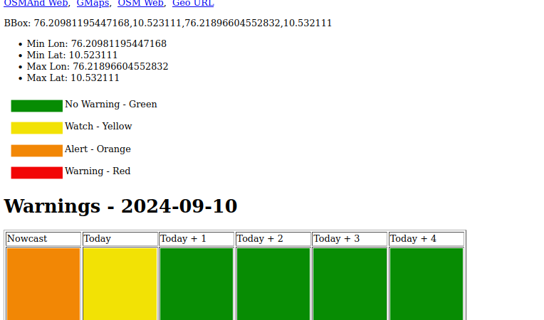
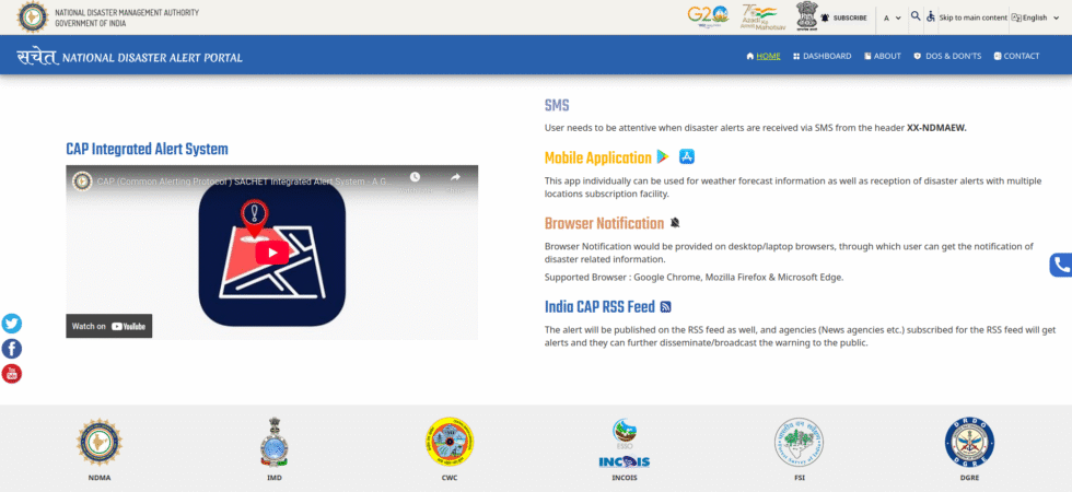
Common Alerting Protocol (CAP) in the Indian Context

If you are interested in tracking weather alerts like I am, you should know about the Common Alerting Protocol (CAP). CAP is a standard XML formatted message that shares disaster/emergency alerts between creators, distributors, and receivers. For example, extreme rain alerts from IMD/Mausam (creator) to phones (receivers) through telecom service providers (distributors). It...

3

Simple IMD Alerts

Table of Contents1 What I want2 IMD WMS Layer3 My plan4 Example pages5 Future improvements6 Note IMD (Indian Meteorological Department) has a district-level alert system. They give rain alerts for today and the next four days. They also have something called NowCast that shows the same alert level for now. Alerts are basically...

OSM Tubro Query for Pet friendly places in Bengaluru 1

Mapping Pet Friendly Places in Bengaluru on OpenStreetMap

I have started mapping pet-friendly places in and around Bengaluru. I am considering the newer areas like Devanahalli, Hosakote, Nelamangala, Anekal, etc. Hence, the area I am mapping is bigger than the city of Bengaluru.  For mapping pet-friendly places, there are two competing tags. pets and pets_allowed. Given that Pets is used a lot, I am...

2

Data: Public, Private and Beyond

The Bachchao Project hosted the “Data: Public, Private and Beyond” from 12th to 15th May 2023 at Panjim, Goa. It’s an Art on Tech exhibition inspired by The Glass Room. I wanted to go but couldn’t due to personal and work reasons.

I showcased Surveillance in the Bengaluru project to attract more contributors to mapping Surveillance in Bengaluru or other cities.

GPSLogger wth CouchDB 1

GPS Logging using GPSLogger and CouchDB

One of the valuable features of Google maps app is GPS logging. It keeps track of where you have been so you can take action if required later. I wanted an open-source, self-hosted version of that.

0

GeoJSON and WordPress

I have been using maps inside WordPress using Maps Maker Pro. You can see all my major road trips were mapped using that. I like it so much that I paid for it. But recently, I have been thinking about moving map content outside WordPress and maybe using WordPress only to display. Then came the question of how and where to store GIS content.