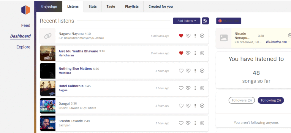
Category: Technology

1

Review: BluArmor C30 Mesh Intercom For Bikers

Table of Contents1 Requirements2 Solution3 Features I like4 Needs Improvement5 Conclusion When I restarted riding, I wanted to be part of the group of friends who had been riding for a while. It meant modernizing certain things related to riding. One of them is a rider intercom to talk to fellow riders. So...

Amphere EV - Reo Li Plus 2

Amphere EV – Reo Li Plus

Table of Contents1 Requirements2 Solution3 Features I like4 Conclusion My father turned seventy recently. He used his scooter to get around the neighborhood—at most, about 40 km in a day and not more than 10 km one way. Scooter allowed him to visit his regular shops, friends, etc. After he turned 70, he...

0

AI Generated Podcast

I generated this podcast a week back using Google’s NotebookLM based on my Twenty Years of Engineering Practice blog post. Before I publish it here, I wanted to check what my friends and colleagues thought about it. Most thought it was an actual podcast discussing my article. They also thought it had a...

Uma with her Baby Radio 2

Baby Radio

Table of Contents1 Requirements2 Solution3 Audio Content Technically, it’s not a radio. No radio waves are involved as such. It’s a Micro SD Card Player like the cassette tape players we used to have. The name Baby Radio is apt only because it only plays what a baby needs to hear, is controlled...

3

Simple IMD Alerts

Table of Contents1 What I want2 IMD WMS Layer3 My plan4 Example pages5 Future improvements6 Note IMD (Indian Meteorological Department) has a district-level alert system. They give rain alerts for today and the next four days. They also have something called NowCast that shows the same alert level for now. Alerts are basically...

Screenshot of the uMap embedding on Surveillance in Bengaluru project. Showing the CCTV data pulled using the Remote URL feature and Overpass Turbo. 2

Creating Maps using uMap

uMap is an open-source project that allows you to overlay your map data on top of the OpenStreetMaps and create custom maps. I have used it to create interactive maps; one example can be found embedded on the Surveillance in Bengaluru project page. It has features for both starters and advanced users. You...