Tagged: Open Data

Sync between LGD and WikiData 2

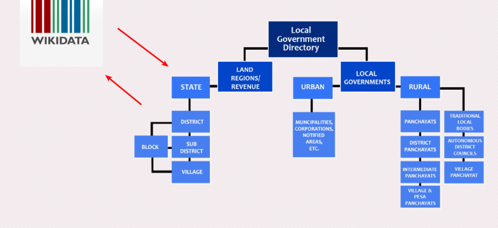
Mapping Local Government Directory to WikiData

The Indian government maintains the directory and hierarchy of local governments and administrative areas in India called the Local Government Directory (LGD). Recently I wanted to map them to WikiData items. This means I wanted to map the administrative areas in the local government to items on WikiData. Update them if necessary.
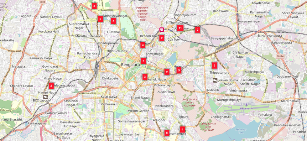
Map of currently mapped cameras of Bangalore 1

Linked List: Simple Ways to Contribute to OpenStreetMap

Recently I completed 1000 edits on OpenStreetMap. It’s a big deal for me :) It happened because I started making small but useful contributions from my phone. I usually map on the phone and then sometimes update them on the desktop, if required. On the phone, I use the following apps, which makes it super easy to edit.

0

COVID-19 India Vaccination Progress Data

India level cumulative Vaccination Progress Data is available as JSON at datameet/covid19 repo in mohfw_vaccination_status.json. You can start using it. Its updated once a day.

0

Scraping Karnataka Reservoir Water Flow Data

Scraper and Data – Karanataka reservoir water inflow and outflow data on weekly basis for all the dams in Karnataka. Published by Karnataka State Natural Disaster Monitoring Centre (KSNDMC) .

1

Getting started with RDF using Blazegraph

This started as a simple exercise of querying WikiData database using their SPQRQL query service. That lead me to studying about RDF and Triplets. I found it very interesting. I spent hours on it. So I thought I might as well write about it here, so I can refer it later. So everything...

1

Coding in 2020 and COVID-19

Like many, this year has been crazy for me too. When there is a crisis that I don’t have control over, I surround myself with good people and work. So I can concentrate on things that I like. COVID-19 was no different, except I couldn’t meet people So it was mostly just work....